Road to Hana Driving Tips: Gas Stations, Timing and Safety
What is the most important driving tip for the Road to Hana?
Fill your tank in Paia or Kahului before you leave — there is no gas station between Paia and Hana, a stretch of road that takes hours to drive. Also plan for the entire day, not a morning excursion, since the round trip with stops routinely takes 10 to 12 hours.
Fuel, timing and the road surface itself
The Hana Highway rewards preparation more than any other drive on Maui. None of what follows is about which waterfall to stop at or how to order your day — that belongs in our stop-by-stop map and our one-day itinerary. This page is about the mechanics of the drive itself: what your car needs, how much time to actually set aside, and how to handle a road that punishes carelessness more than it punishes slow driving.
There is no gas station between Paia and Hana — plan around it, not through it
This is the single fact that trips up more visitors than any other detail of the drive. Once you pull out of Paia heading east, there is no fuel available for the entire stretch to Hana — roughly two and a half hours of driving without a single pump. Not a small one, not an expensive one, not one you can find “just around the bend.” It simply does not exist along the route.
Hana town does have one small gas station, but treat it as a fallback, not a plan. Its hours are limited, it has been known to run out of a grade of fuel, and a line can form quickly since every driver on the road that day has the same idea. If you arrive expecting to fill up there and find it closed or out of gas, you are stuck with whatever is in your tank for the return trip too — and the return trip is just as long as the way out.
The fix is simple and non-negotiable: fill your tank completely before you leave, either in Paia itself or in Kahului on your way through. Do not leave on a half tank thinking you will “top up later.” There is no later until you are back on this side of the island. A full tank at the start comfortably covers the entire round trip for almost any standard rental car, including the detours to waterfalls and lookouts along the way.
If your gauge drops below half by the time you reach Hana, that is your signal to think seriously about turning back rather than continuing further east toward Kipahulu. Running out of fuel on a narrow one-lane stretch with no cell signal is a genuinely bad situation, not just an inconvenience.
| Fuel checkpoint | What to do |
|---|---|
| Kahului or Paia, before departure | Fill the tank completely — this is your only real opportunity |
| Along the highway (Huelo to Hana) | No stations exist; do not expect one |
| Hana town | One small pump exists but has limited hours and no guaranteed fuel — backup only, not a plan |
| Return leg | Same tank you left with, minus whatever the drive to Kipahulu used |
Block off the entire day, not a morning
A common mistake is treating the Road to Hana like a half-day excursion that wraps up by lunch. The driving time alone — Paia to Hana, non-stop — runs about two and a half hours each way. Add even a modest handful of stops for photos, a short walk, or a waterfall view, and most visitors spend the full day on the round trip, often 10 to 12 hours from the time they leave their hotel to the time they get back.
This matters for how you plan your morning and your evening, even though the specific stops themselves aren’t the subject here. Leave early enough that you are not racing daylight on the way back — the road has no lighting, few guardrails in places, and driving it after dark adds real risk for no good reason. If you are staying in West Maui or South Maui, the added drive time to reach Paia in the first place — see typical inter-town drive times — should factor into what time you actually need to leave your room.
Road conditions: what the pavement is actually like
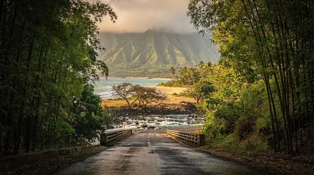
The good news is that the entire route to Hana, and on to Kipahulu, is paved. You do not need a 4x4 or a lifted SUV to make this drive — a standard rental sedan handles it without issue in dry weather. What makes the drive demanding isn’t the surface, it’s the geometry: about 620 curves and 59 bridges packed into roughly 100 kilometers, a majority of the bridges narrowing to a single lane.
Rain changes the calculation. The road can develop standing water in low points, visibility drops on blind curves, and the shoulder — where one exists at all — turns soft. If you’re driving during or after a heavy rain event, slow down further than you think you need to and increase your following distance, especially near the many small stream crossings.
Rental car restrictions you need to check before you leave the lot
Because the pavement itself is fine for any car, the real restriction to watch for is contractual, not mechanical. Many standard rental agreements on Maui exclude two specific roads: the Piilani Highway south of the Kipahulu district of Haleakala National Park, and the Kahekili Highway in the island’s northwest. Driving either one anyway — even if your car handles it physically without any trouble — can void your insurance coverage entirely if something goes wrong.
Read your rental agreement, or ask the counter agent directly, before you commit to a route that continues past Kipahulu and loops around the island’s back side. If the agreement excludes it, that section of road is off-limits for your car regardless of how capable it looks on a map.
How one-lane bridges actually work
With 59 bridges on the route and most of them narrowing to a single lane, you will be sharing the road constantly with oncoming traffic in a very literal sense. The convention is straightforward: whoever reaches the bridge first generally has the right of way, and where a yield sign is posted facing your direction, you wait for the oncoming car or cars to clear before proceeding. A wave or a flash of headlights from the other driver is the informal signal that you’re clear to go.
None of this is written down as strict law enforced by anyone standing at the bridge — it runs on driver courtesy, patience, and eye contact. Rushing a bridge crossing when another car is already committed to it is the single most common source of tension on this road. Slow down as you approach every one-lane bridge, regardless of whether you see oncoming traffic, since blind curves on either side often hide a car until the last moment.
Cell signal, navigation and staying findable
Coverage becomes patchy almost immediately past Paia and disappears for long stretches beyond that. Do not count on live traffic rerouting, a maps app pulling fresh data, or a phone call for help if you have a mechanical issue or a flat tire in the middle of the drive. Download offline maps before you leave cell range, and consider telling someone your rough plan and expected return time — a simple habit that costs nothing and matters if you do run into trouble on a stretch with no other cars for several minutes at a time.
A physical rental car with insurance is safer here than assuming rideshare or a tow truck can reach you quickly. Response times on this road, even for scheduled roadside assistance, can run into hours given the distance from Kahului and the narrow geometry of the road itself.
Traffic patterns and when to leave
Nearly every self-driver and every guided van on the island departs in the same narrow window, roughly 6 to 7 in the morning, which concentrates traffic on the tightest early stretch near Twin Falls and the first several one-lane bridges. If you can leave right at 6 a.m., you’ll often beat the bulk of that traffic. If an early start isn’t realistic, waiting until closer to 9 a.m. — after the morning wave has thinned out — is the other reasonable option, accepting that you’ll be driving back later in the day as a trade-off.
Either way, avoid leaving mid-morning in that crowded 7:30 to 8:30 window if you have flexibility, since that is when the road is busiest with both self-drivers and tour vans converging on the same narrow bridges at once.
Pulling over safely
Shoulders are narrow to nonexistent for much of the route. When you want to stop for a photo or to let a faster car pass, use only the designated pullouts rather than stopping on the road itself or on a blind curve. Stopping on the pavement, even briefly, on a road with this many curves and bridges creates real risk for the cars behind you that may not see you until they’re close. If no legal, visible pullout is available, keep driving to the next one rather than forcing a stop.
Guided alternatives, if the logistics feel like too much
If reading through all of this makes the self-drive option feel like more coordination than you want to manage, a guided option removes the fuel planning, the bridge etiquette, and the navigation entirely. A tour like the guided day tour with lunch included hands the driving and the fuel logistics to someone who does this route regularly. For a smaller, more flexible group, the private open-air jeep tour covers the same ground without you needing to track a fuel gauge at all.
If you’d rather drive yourself but want structure without a live guide, the GPS-guided self-driving audio tour narrates the route as you go in your own rental car, which still means you’re responsible for fuel and bridge etiquette, but removes the guesswork about what you’re looking at. For something more comfortable for the return leg, the private Cadillac Escalade tour with pickup takes the entire day’s driving off your hands, front door to front door.
The deeper comparison between guiding yourself and booking one of these is covered in our guided tour versus self-drive breakdown — this page is only about what to do with the wheel in your own hands if you choose that route.
Getting the car itself sorted before you reach Paia
None of the fuel and timing advice above matters if the rental car logistics trip you up first. Most visitors land at Kahului’s airport and pick up their car there, so it’s worth deciding in advance whether you’re renting directly at OGG or comparing that against a private transfer plus renting closer to your hotel. Either way, the tank should already be full — or filled at the first station you pass — well before you turn onto the Hana Highway itself, since Kahului and Paia are your last realistic fill-up points of the day.
There is no bus service to fall back on
Unlike getting around Kihei or Lahaina, where the Maui Bus covers most in-town trips, there is no public transit option for the Hana Highway at all. The route runs through open country between towns, not along a bus corridor, so a rental car, a guided van, or one of the tours above are the only realistic ways to see this side of the island. Plan your transportation the same day you plan your fuel stop — there’s no last-minute bus to catch if a rental falls through.
What the drive is actually leading you to
The mechanics in this guide — fuel, timing, bridges, signal — exist to get you safely to Hana and the coastline beyond it, not as an end in themselves. Along the way, the two stops that most often reshape a driver’s schedule are Twin Falls, right at the start where traffic is heaviest, and the Pipiwai Trail to Waimoku Falls near the far end in Kipahulu. If your route continues past Hana itself, Waianapanapa’s black sand beach requires an advance reservation — that’s a booking to make before you leave, not something you can arrange from the road. A shorter, low-stakes way to get a feel for the highway’s pace without committing to the full day is stopping in Paia itself before you decide how far east to go.
Weather can change the plan on short notice
The driving advice above assumes typical conditions, but Maui’s wetter season runs roughly November through April, and month-by-month weather patterns are worth checking before you commit to a specific date, since a wet Hana Highway is a genuinely different drive than a dry one. Outside of ordinary rain, the wider Pacific hurricane season runs from June through November — see what that means in practice for a Maui trip — and any storm watch or warning is a reason to postpone the drive entirely rather than push through it.
For a sense of how residents who drive this road every week think about pacing and etiquette, this look at the Road to Hana through local eyes is a useful complement to the mechanical advice above.
Road to Hana driving FAQ
Is there really no gas station between Paia and Hana?
Correct. Once you leave Paia, there is no fuel available until you reach Hana town itself, and even there the pump has limited hours. The safe rule is to leave with a full tank and treat anything below half a tank as a reason to turn around rather than push on.
Does Hana town have a gas station?
There is one small pump in Hana, but hours are limited and it can be closed, out of a grade, or have a line. Do not plan your fuel budget around it. Treat it as a backup, not a plan.
How long does the drive from Paia to Hana actually take?
Around two and a half hours with no stops at all. With even a modest number of photo and waterfall stops, most drivers spend the full day on the round trip, often 10 to 12 hours door to door.
Is a 4x4 or SUV necessary for the Hana Highway?
No. The road is paved the entire way to Hana and beyond to Kipahulu, and a standard sedan handles it fine in dry conditions. What matters more is checking your rental contract, since some agreements restrict driving south of the national park on the Piilani Highway.
What should I check in my rental car agreement before driving to Hana?
Look specifically for restrictions on the Piilani Highway south of Kipahulu and on the Kahekili Highway in northwest Maui. Many standard rental contracts exclude one or both of these roads, and driving them anyway can void your insurance coverage.
How many one-lane bridges are on the Hana Highway, and how do they work?
There are 59 bridges along the route, and a majority are single-lane. The general rule is that the driver who reaches the bridge first, or the side with a yield sign facing them, waits for oncoming traffic to clear. A wave or flash of headlights from the other driver is a common courtesy signal to go ahead.
Is cell phone signal reliable along the drive?
No. Coverage is patchy to nonexistent for long stretches past Paia, so do not rely on a phone map for real-time navigation or on a call for help if something goes wrong. Download offline maps and tell someone your general plan before you leave.
When should I start driving to avoid the worst traffic?
Most self-driving visitors and every guided van leave between 6 and 7 in the morning, which bunches traffic on the narrow early stretch near Twin Falls. Leaving by 6 a.m. or waiting until closer to 9 a.m. can mean noticeably less congestion on the first hour of the drive.
Getting around Maui on GetYourGuide
Verified deep-linked GetYourGuide tours. Book through these links and we earn a small commission at no cost to you.
GetYourGuide does not provide a product photo for this activity — the image shows the meeting point, photographed by us.