Kahoolawe: The Maui-Adjacent Island You Cannot Visit
The island south of Maui that no boat will take you to
The first time I noticed Kahoolawe, I wasn’t looking for it. I was on a boat somewhere between Molokini and the open channel, and the person next to me pointed at a long, low, brown shape on the horizon and asked our crew if we were headed there. The captain said no, we weren’t, nobody was, and moved on to talking about the snorkel gear. That was it. No island tour, no explanation beyond a short “it’s closed,” and a boatload of people who spent the rest of the ride glancing back at it.
I’ve since asked that question in a few different forms, on a few different boats, and gotten roughly the same answer every time. So this page exists because the island is genuinely visible from parts of South Maui and from most boats working the Molokini run, and because “it’s closed” deserves more than three words.
What Kahoolawe actually is
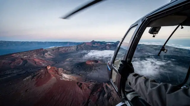
Kahoolawe is the smallest of the eight main Hawaiian islands, sitting about seven miles off Maui’s southern coast, past Makena and the lava field beyond La Perouse Bay. It’s part of Maui County, uninhabited, and roughly a third the size of Maui’s own Haleakala crater basin in land area. From a distance it looks dry and reddish-brown, which is accurate: decades of goat grazing and military use stripped much of its original vegetation, and erosion did the rest.
Before any of that, Kahoolawe had a place in Hawaiian navigation and religious practice, tied to voyaging traditions and to the god Kanaloa. That history didn’t stop the island from being handed over to something much less reverent in the twentieth century.
Why it’s a bombing range, not a beach
Kahoolawe was used as a U.S. military training and target range from the early 1940s until 1990. For roughly fifty years, it took live fire, practice bombs, and naval shelling. That’s not a footnote you can build a tour around — it’s the reason no tour exists.
After sustained protest and legal action by Native Hawaiian activists in the 1970s and 1980s, the bombing stopped in 1990, and the island was formally returned to the State of Hawaii in the early 1990s under conditions that included ordnance cleanup. A large, expensive clearance effort followed, run by the Navy, and it genuinely removed a significant volume of unexploded ordnance from the surface and near-surface soil.
What it didn’t do is certify the island safe for casual public access. Ordnance clearance on a former bombing range is never total — deeper or buried material can remain, and some areas were left restricted rather than declared clear. That’s the practical reason the island stays closed: not neglect, not bureaucracy for its own sake, but an actual and ongoing physical hazard.
So who does go there
The island isn’t fully sealed off from everyone, which is where some of the confusion comes from. The Kahoolawe Island Reserve Commission manages it, and organized cultural access is arranged for Native Hawaiian practitioners for ceremony, restoration planting, and stewardship work, along with ordnance-clearance and environmental crews. These trips are logistically arranged, safety-briefed, and not something a visiting traveler can book, join, or replicate. There is no version of “ask nicely” or “pay for a special permit” that gets a tourist onto Kahoolawe. If you see an offer that claims otherwise, it isn’t legitimate.
I want to be direct about that because it’s the one place where a well-meaning guide could do real harm: implying a workaround exists when it doesn’t. It doesn’t.
Where you can actually see it from
You don’t need a special trip to see Kahoolawe — you’re likely to see it anyway if you spend time in the right places.
| Where you are | What you’ll see |
|---|---|
| Makena and La Perouse Bay | Kahoolawe fills much of the southern horizon on a clear day |
| A Molokini snorkel boat out of Maalaea or Kihei | Often visible past Molokini itself, further out |
| A boat heading toward Lanai | Kahoolawe sits roughly between Maui and Lanai, visible off to one side |
| South-facing hotel rooms in Wailea or Kihei | A distant shape on the horizon, more visible at sunrise or in clear winter air |
If your trip includes a Molokini snorkel tour or a boat toward Lanai, ask your crew to point Kahoolawe out. Most are used to the question and can tell you what you’re looking at without pretending it’s a stop on the itinerary.
a short morning snorkel run out to Molokini, with Kahoolawe visible on the horizon past the crater is a reasonable way to see it from the water without any illusion of landing there. A longer snorkel crossing toward Lanai passes closer to Kahoolawe’s northern side on some routes, again strictly offshore. And if you’re visiting in whale season, a combined Molokini snorkel and whale-watching trip covers more of that southern water, with Kahoolawe as a backdrop rather than a destination.
What I’d tell a first-time visitor
Don’t build any part of your Maui plans around Kahoolawe — no tour promises access, and any listing that hints otherwise should be treated with suspicion. Do look for it. It’s one of those details that makes a trip feel less like a postcard and more like a real place with a real, complicated history: a fifty-year bombing range, a hard-won return, and an island still being cleared of what was left behind.
If you’re curious about the bigger picture of Maui’s coastline and neighboring islands, the Maui vs. Big Island comparison and the single ferry route to Lanai are useful context — Kahoolawe is the quiet exception among Maui’s visible neighbors, the one island in view that isn’t an option no matter how much time or money you have.
For planning the rest of your trip, how many days you need in Maui and where to stay in Maui the first time are good next stops. If South Maui’s coastline is drawing you in for the view alone, Wailea versus Kaanapali covers which side of the island puts Kahoolawe in your daily view.
Kahoolawe: your questions answered
Can you visit Kahoolawe from Maui?
No. It has been closed to the public since the military stopped using it as a bombing range. Unexploded ordnance remains in the ground and in the surrounding waters, and no tour operator is permitted to land visitors there.
Why is Kahoolawe closed to tourists?
The U.S. Navy used Kahoolawe as a live-fire training and bombing range from the 1940s until 1990. Decades of ordnance clearance work removed a large amount of unexploded material, but not all of it, and the island was never certified fully safe for unrestricted public access.
Can I see Kahoolawe from Maui?
Yes. Kahoolawe is visible from South Maui, from Makena and La Perouse Bay, and from most boats heading to Molokini or Lanai. Seeing it from a distance is the only legal way most visitors experience the island.
Does any boat tour stop at Kahoolawe?
No commercial tour lands passengers on Kahoolawe. Boats that pass near it, on the way to Molokini or Lanai, stay offshore and treat it as a scenic point of interest, not a destination.
Who is allowed on Kahoolawe today?
Access is limited to the Kahoolawe Island Reserve Commission, cultural practitioners on organized access trips, and ordnance-clearance or restoration crews. These are not tourist visits and are not open to the public.
Is Kahoolawe the same as Molokini?
No. Molokini is the small crescent-shaped islet where snorkel boats anchor; Kahoolawe is a much larger island a few miles further south. They’re often visible in the same view from a boat, which is where the confusion usually starts.
Tours for a first visit on GetYourGuide
Verified deep-linked GetYourGuide tours. Book through these links and we earn a small commission at no cost to you.
GetYourGuide does not provide a product photo for this activity — the image shows the meeting point, photographed by us.