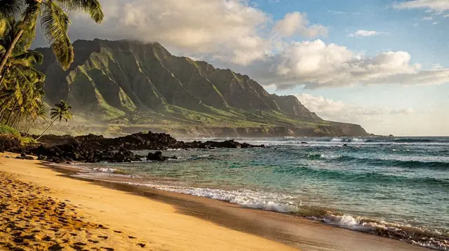
Maui does not work like a single beach town with everything a short walk apart. It is an island built around two volcanoes — the older, eroded West Maui Mountains and the younger, much larger Haleakala — with a low, flat isthmus connecting them. Every visitor lands at the same place, Kahului Airport (OGG) in that isthmus, and from there the island splits into six regions that each feel like a different trip: a resort coast, a quieter beach coast, an agricultural upland, a rainforest drive, and a stretch of open water dotted with a crater and a neighboring island.
There is no interstate highway anywhere on Maui. The roads that link the regions are the Honoapiilani Highway, the Piilani Highway, the Hana Highway, and the Haleakala Highway — two-lane roads that hug the coast or climb the mountain, not high-speed connectors. That single fact shapes almost everything about planning a Maui trip: distances that look short on a map take real time, and a rental car (or a tour that includes pickup) is close to a requirement for seeing more than one region.
Kahului: the isthmus you land in first
Kahului, in Central Maui, is where nearly every visit begins. The airport sits here, along with the island’s main shopping centers and the rental car counters. Neighboring Wailuku is the county seat, and just above it, Iao Valley State Monument draws day-trippers to its green, eroded peak — a stop that now requires a reserved time slot and parking fee for non-residents. Most travelers do not stay in Central Maui; they land, pick up a car, and drive on to a resort coast. But nearly every day tour on the island, from Haleakala sunrise vans to circle-island trips, is timed around this isthmus, since it is the crossroads the other five regions radiate from.
West Maui: Lahaina and Kaanapali
The west coast is the island’s original resort strip, and also the site of its most serious recent event. Lahaina burned on August 8, 2023, and Front Street is not the intact row of galleries and shops it once was. The town is rebuilding; the historic banyan tree survived the fire but access around it remains restricted. A guide worth trusting says what has reopened rather than either overstating the recovery or sending visitors to see the damage — and for the current state on any given week, the county’s own updates are the reliable source.
What has continued operating is the harbor: Lahaina and nearby Maalaea remain the two departure points for catamarans, sunset sails, and snorkel boats. A few miles up the coast, Kaanapali is the resort beach proper — a continuous five-kilometer stretch of sand, a pedestrian Beach Walk linking the hotels, and Black Rock at its northern tip, one of the better shore-entry snorkel spots on the island. Further north, Napili and Kapalua bays are smaller and more sheltered, often calmer choices for families and for spotting turtles, while Honolua Bay is a marine reserve that is excellent in summer and frequently unswimmable once winter swell arrives.
South Maui: Kihei, Wailea, and Makena
Across the isthmus and south, the coast turns dry and sunny most of the year. Kihei is the more affordable, casual base, strung along the Kamaole Beach Parks I, II, and III, with condos rather than resorts and the Kealia Pond National Wildlife Refuge at its northern edge. Continuing south, Wailea is the resort coast, fronted by a public 2.5-kilometer coastal path, and Makena begins where the hotels stop. Big Beach (Oneloa) is striking but its shorebreak injures people every year and is not a beach for small children; Little Beach, just over the rocky point, is a traditionally clothing-optional stretch.
Offshore from Makena, Turtle Town is the spot where snorkelers most often see green sea turtles, though nothing is guaranteed and federal law requires staying at least 3 meters away. The road itself ends at La Perouse Bay, on the island’s most recent lava flow, dating to the late 1700s — beyond it is an exposed trail over sharp rock, with no shade and no water. Maalaea, between South and West Maui, is a working harbor rather than a town to stay in: it is the shortest boat ride to Molokini and home to the Maui Ocean Center, and its afternoons turn windy fast, which is why most boats leave early.
Upcountry and Haleakala
Above the old sugar plantations, the slopes of Haleakala climb through Kula and Makawao, past lavender and goat farms, to a 3,055-meter summit inside Haleakala National Park. This is where sunrise reservations, cold-weather layers, and altitude sickness become real planning concerns rather than footnotes — entering the summit district between 3 a.m. and 7 a.m. requires a separate reservation on recreation.gov, released 60 days ahead. Sunset, by contrast, needs only the park’s standard three-day entrance fee. The mountain is dormant, not extinct, and its “crater” is actually an erosional valley carved by two rivers rather than a volcanic caldera in the strict sense. Commercial downhill bike tours now start below the park boundary, not from the summit itself, a change in place since 2007.
East Maui: Paia, Hookipa, and the road to Hana
The windward side of the island is a different climate entirely — wetter, greener, and reached by the roughly 100-kilometer Hana Highway, with its hundreds of curves and dozens of one-lane bridges. Hana itself is a small village with limited services: no supermarket, no nightlife, and no gas station anywhere between Paia and Hana, so travelers fill up before setting out. Along the way, Waianapanapa State Park’s black-sand beach now requires a timed online reservation and a separate parking fee for non-residents, and the Kipahulu pools near Hana, part of Haleakala National Park’s coastal district, close to swimming after heavy rain because of flash-flood risk. Paia and nearby Hookipa are a windsurfing and big-wave surf coast, not a beginner’s beach — Hookipa in particular is for watching, not for a first surf lesson.
Because the drive alone takes a full day round trip with stops, many visitors choose a guided van instead of self-driving, which removes the narrow bridges, the parking search, and the return drive after a long day from the equation entirely.
the whole island: Molokini and beyond
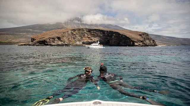
The sixth region is not a place on land but a set of trips that leave the coast altogether. Molokini, a crescent-shaped volcanic islet about four kilometers off the south shore, cannot be walked on — boats anchor beside it and snorkelers enter the water directly from the deck, inside a state marine reserve. Morning trips generally have calmer water and better visibility than afternoon ones, since wind builds through the day; that is also why afternoon departures tend to be priced lower. A typical outing pairs Molokini with a second stop, often Turtle Town, and departs from Maalaea, Kihei, or Lahaina depending on the operator.
This is also the category for circle-island day tours, helicopter flights over valleys with no road access, and the handful of day trips that leave Maui by air for a neighboring island — Kahului is the only airport with the inter-island flight schedule to make that practical in a single day.
Getting between the regions
| Route | Approximate drive time |
|---|---|
| Kahului to Lahaina | about 45 minutes |
| Kahului to Wailea | about 30 minutes |
| Kahului to the Haleakala summit | about 2 hours |
| Paia to Hana (one way, no stops) | about 2.5 hours |
Maui has a single ferry route, between Lahaina or Maalaea and Manele on the island of Lanai, taking roughly an hour. There is no ferry to any other island in the chain — reaching Oahu, Kauai, or the Big Island means flying out of OGG. The county-run Maui Bus links towns within Central Maui, South Maui, and West Maui, but it does not climb to the Haleakala summit and does not run the Hana Highway, so a car-free stay is realistic only for travelers who plan to stay within one resort area and book tours that include pickup.
Choosing which of these regions to base in, and for how many nights, are questions this page leaves to two companion guides: where to stay between West Maui and South Maui and how many days to plan for. What matters here is the shape of the island itself — six regions, one airport, no interstate, and a rental car as the thread that ties the trip together. For travelers weighing whether a car is worth the cost at all, this guide to renting versus relying on tours goes through the tradeoffs region by region.
A few of the island’s better-known day trips are worth booking ahead rather than deciding on arrival. A guided drive along the Hana Highway with stops for waterfalls and lunch, such as the Road to Hana sightseeing tour, covers the East Maui region in a single long day without the return-drive fatigue of self-driving. For the water, a Molokini snorkeling trip departing South Maui reaches the crater before the midday wind picks up. For the summit, a Haleakala sunrise tour with hotel pickup handles the timed-entry reservation and the pre-dawn drive up from the coast. Winter visitors often add an the whole island whale-watching trip into the Auau Channel, which runs only during the December-to-April season.
Before booking anything, it helps to know which season you are traveling in: the dry months from May to October favor the coasts, while whale season from December to March draws visitors specifically to the boats out of Lahaina and Maalaea. Details on both are in the guide to Maui’s best time to visit, and travelers deciding between Maui and its volcanic neighbor may want the comparison with the Big Island for context on why the two islands are so often confused.
Maui island FAQ: regions, roads, and getting around
Do I need a rental car to see all of Maui?
For most itineraries, yes. The Maui Bus connects towns within a region, but it does not reach the summit of Haleakala or run the Hana Highway, so a car — or a booked tour with pickup — is how travelers actually move between regions.
What is the only airport for reaching Maui?
Kahului Airport (OGG), in Central Maui, is the sole airport receiving flights from the US mainland and regular inter-island flights. Kapalua and Hana have small airstrips with no long-distance service.
How many regions does Maui have, and what are they?
Six: West Maui (Lahaina, Kaanapali), South Maui (Kihei, Wailea, Makena), Central Maui (Kahului, Wailuku), Upcountry-Haleakala, East Maui toward Hana, and the whole island trips that include the boats to Molokini and flights to neighboring islands.
Is there an interstate highway on Maui?
No. Maui has no interstate system at all. The main routes are the Honoapiilani Highway (30), the Piilani Highway (31), the Hana Highway (360), and the Haleakala Highway (37/377/378), each a two-lane coastal or mountain road.
Can I visit Maui without driving the Road to Hana myself?
Yes. Guided van tours run the Hana Highway with a driver, which removes the narrow one-lane bridges and the long return drive from the traveler’s day, and several the whole island tours cover Haleakala or a full loop of the island the same way.
What is the difference between Maui and the Big Island?
They are separate islands in the same state. The Big Island (Hawaii Island) has the active Kilauea volcano; Maui has no active lava, and its highest point, Haleakala, is dormant, not extinct.
Where do most day tours and boats depart from?
Snorkel and sunset boats leave mainly from Lahaina and Maalaea harbors; Haleakala sunrise and Road to Hana tours pick up guests in West Maui and South Maui hotels very early in the morning because of the drive time involved.